
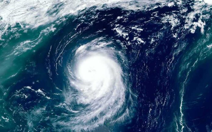
Typhoon Dolphin is pushing toward Japan’s southern islands, and officials are warning of heavy rain, strong winds, and rough seas.
Quick Take
- Typhoon Dolphin is moving westward toward Japan, with Okinawa and the Amami chain in the forecast path.
- Weather coverage says the storm was expected to reach Okinawa after crossing the Ogasawara Islands first.
- Forecast updates pointed to violent winds, storm surge, and dangerous waves across southwest Japan.
- The public record is mostly forecast agreement, not a strong rebuttal to the storm track.
Storm Track Points South of Japan
Reuters’ reported theme is simple: Dolphin is moving toward Japan, not away from it. Al Jazeera said the typhoon was heading westward across the Pacific toward Japan, with Okinawa residents told to prepare for severe weather and landfall on Okinawa expected on Friday morning. Weathernews also placed the storm on a westward track south of Japan, with a close approach to Okinawa forecast for August 7.
That track matters because the storm already brushed Japan’s outer islands. Al Jazeera reported strong winds on the Ogasawara, or Bonin, Islands, which it described as the first part of Japan the typhoon reached. Other coverage and forecast maps pointed to a wider corridor that included the Ryukyu Islands, the Daito Islands, Okinawa, and Amami, showing how the threat stretched across southwest Japan rather than one single point.
What the Forecast Says Japan Could Face
The main risk is not just where Dolphin goes, but what it brings. Weathernews said violent winds, extreme wave heights, heavy rainfall, and storm surge were forecast for Okinawa and Amami through around August 9, with conditions severe enough to partially collapse structures. Al Jazeera similarly warned of severe weather for Okinawa, while Reuters-linked social posts described evacuations and flight disruption as the storm approached.
That kind of forecast can change fast, which is why live typhoon coverage often sounds firmer than the science really is. Stars and Stripes reported that Joint Typhoon Warning Center guidance still showed a spread among solutions early in the storm’s life, even while the broad direction toward Japan remained clear. Dim Sum Daily later reported that the projected route had shifted south, but still kept the Ryukyu Islands and waters near Okinawa in the warning zone.
Why the Public Record Still Points to Japan
The available counter-evidence does not overturn the core claim. It mainly repeats the same forecast direction through different outlets, including NHK World, Weathernews, and other trackers that also expected Dolphin to approach Okinawa or the Amami Islands. That means the public record shows forecast convergence, not a documented correction proving the Japan track was wrong.
Hundreds of thousands of people in southwestern Japan were ordered to evacuate and more than 500 flights cancelled as slow-moving Typhoon Dolphin approached the region to bring violent winds, heavy rain and high waves https://t.co/PWXFb2eoxA
— Reuters (@Reuters) August 7, 2026
That matters beyond one storm. Live typhoon reporting can expose a wider problem in public life: official warnings are necessary, but people often get them only after models, agencies, and media have already narrowed the field to a few likely outcomes. In this case, the story is not confusion about whether Japan is in danger. The story is that a powerful storm was still on a path that could hit crowded southern islands, and the risk window stayed open as forecasts updated.
Sources:
youtube.com, aljazeera.com, nytimes.com, facebook.com, dimsumdaily.hk, thestar.com.my
© nationalusnews.com 2026. All rights reserved.